How to Read an MVUM: Which Forest Roads Your 4x4 or UTV Can Use
An MVUM (Motor Vehicle Use Map) tells you three things about every road and trail in a national forest: which vehicles may use it (the line style), when (a seasonal symbol plus a dates table), and whether you may pull off it to camp or park. If a route isn't drawn on the current MVUM, it's closed to motor vehicles, even if it looks well used. Read the line symbol against your own vehicle's plate status and width before you turn onto it.
That last part trips up more side-by-side owners than anyone else. A plated Jeep and an unplated 64-inch UTV can stand at the same junction and face different answers. The table below decodes every standard symbol, and the route checker after it lets you test your own rig.
What each MVUM symbol allows
Every MVUM uses the same set of route classes, listed in the Forest Service's own MVUM symbology data. Line colors and patterns can look a little different from forest to forest, so always match the line to the legend printed on your map. The class names don't change.
| MVUM class | Who may drive it | Typical vehicles | Common mistake |
|---|---|---|---|
| Road open to highway-legal vehicles only | Vehicles licensed under state law for general operation on all public roads | Plated cars, trucks, SUVs; street-legal UTVs or ATVs if your state plates them for general road use | Riding an unplated ATV or UTV on it to reach a trailhead |
| Road open to all vehicles | Any motor vehicle, licensed or not (not oversize or overweight vehicles under state law) | Everything from a sedan to an unplated quad | Assuming "all vehicles" means a car can make it |
| Trail open to all vehicles | Any motor vehicle, including full-size 4x4s | Jeeps, trucks, wide UTVs | Expecting road-grade surface; these are often rugged and narrow |
| Trail open to vehicles 50" or less in width | Vehicles 50 inches or less at the widest point | ATVs, 50-inch trail UTVs, motorcycles | Taking a 60- or 64-inch side-by-side onto it |
| Trail open to wheeled vehicles 50" or less | Same width limit, wheeled only | ATVs, narrow UTVs, motorcycles | Bringing a tracked machine |
| Trail open to motorcycles only | Two-wheeled motorcycles (one legend adds "sidecars are not permitted") | Dirt bikes, plated dual-sports | Riding an ATV on singletrack |
| Special designation | Whatever the map's special designation table says for that route number | Varies | Not looking up the route number |
| Seasonal symbol (used with any of the above) | Only during the dates in the seasonal designations table | Varies by class | Treating a seasonal road as open in November |
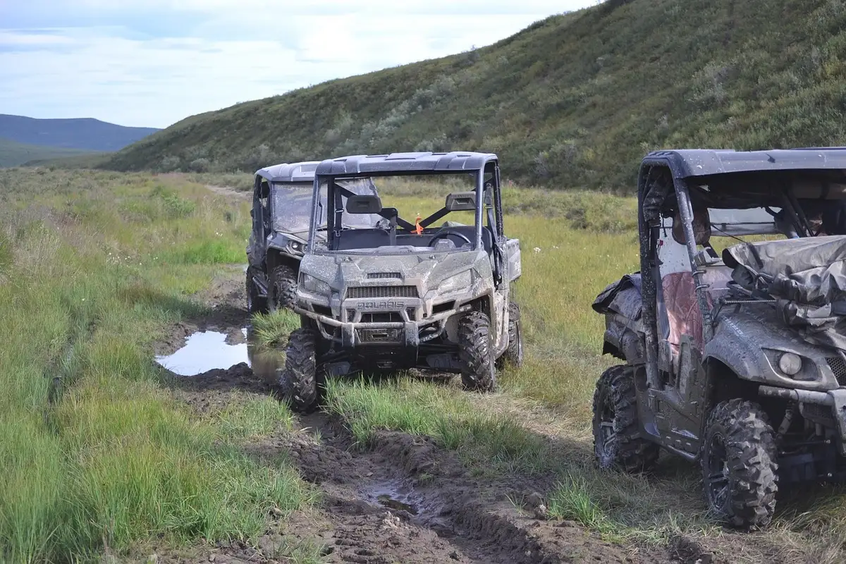
The 50-inch line matters because many sport side-by-sides are wider. Polaris's RZR XP 1000 owner's manual lists the RZR XP at 64 inches wide, so it's shut out of every 50-inch trail no matter how capable it is.
Measure across the widest point, which is usually the outside of the tire sidewalls or the fender flares. Wheel spacers and wider aftermarket wheels can push a machine that was 50 inches from the factory over the limit. If you're unsure where your machine falls, our explainer on how a side-by-side differs from an ATV covers the basic size classes.
MVUM Route Checker: is this route legal for your vehicle?
Pick your vehicle, the symbol drawn on the route, and what the seasonal table says. The checker applies the same class rules as the table above and tells you whether the route is legal for you, and why.
The checker encodes the vehicle classes in 36 CFR 212.51 and the standard MVUM legend. It can't see temporary closure orders, forest-specific special designations or your state's OHV laws, so treat the result as a first check, not legal advice.
Legal isn't the same as drivable. The Forest Service's own FAQ warns that a low-standard road may be open to all motor vehicles, including passenger cars and motorhomes, "although it may not be wise to do so." The map is about the law, not the surface.
How to read an MVUM in six checks
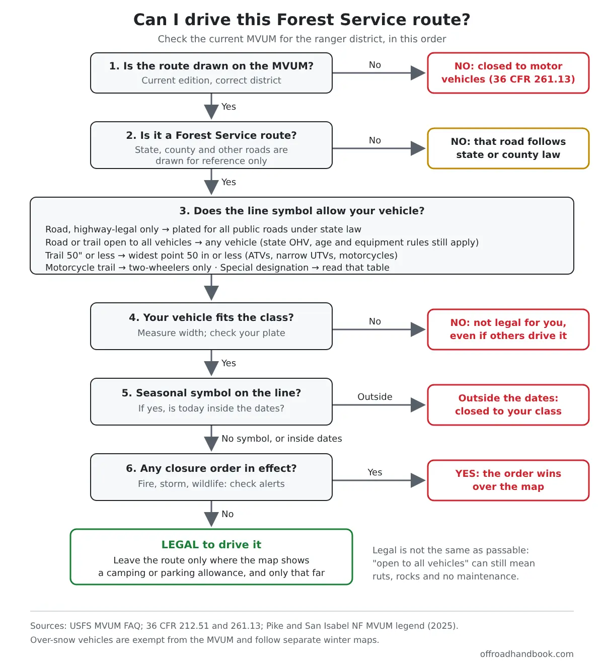
- Is the route drawn on the current MVUM for that ranger district? If not, it's closed to public motor vehicles. Under 36 CFR 261.13, once a district's map is published, operating off its designations is prohibited. A route doesn't need a sign to be open, and a sign-free two-track isn't open just because it exists.
- Is it a Forest Service route? MVUMs also draw interstates and state, county and other roads so you can see how routes connect. Those follow state or county law, not the MVUM classes.
- What does the line symbol allow? Match it to the legend: highway-legal only, all vehicles, 50 inches or less, motorcycles, or special designation.
- Does your vehicle fit that class? Check your plate status and measure your width. If not, the route is closed to you, even when you see other vehicles on it.
- Is there a seasonal symbol? If so, find the route number in the seasonal designations table and confirm today's date falls inside the open dates for your vehicle class.
- Is a closure order in effect? Fire, flood and storm-damage closures can shut routes the map shows as open. One Pike and San Isabel map notes a road "physically blocked and impassable" after a fire. Check the forest's alerts page or call the district.
Need help with the clearance side? Our guide to what a 2WD vehicle needs on Forest Service roads explains maintenance levels, and the approach angle calculator shows whether your bumper clears the ledge at the start of a rough trail.
Reading the seasonal designations table
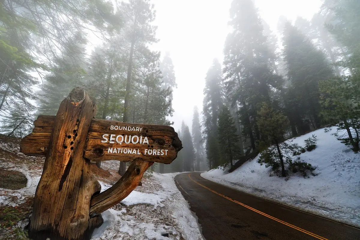
The seasonal symbol is a marker drawn alongside a normal road or trail line. On its own it tells you nothing; one legend describes it as a symbol "used in conjunction with one of the other road or trail symbols" that sends you to the seasonal designations table.
That table lists route numbers with open dates, and the dates can differ by vehicle class on the same route. The Forest Service's MVUM data keeps a separate "dates open" field for passenger vehicles, high-clearance vehicles, ATVs, motorcycles and other OHV types, so a road might open to highway-legal trucks weeks before it opens to ATVs.
Forests close routes seasonally to reduce wildlife disturbance, protect people from unsafe or impassable conditions, and protect soil and water, according to the MVUM FAQ. In late fall that's why a road you drove in September can be closed now, even with no snow on it.
Very short routes get their own trick. Where a route is too short to draw a symbol, the map prints its number in a small box, and you look it up in a short route table. If you print only part of a map, the Olympic National Forest reminds you to also print the cover sheet, the seasonal and special vehicle designation table, the dispersed camping table and the map index.
Snowmobiles are a separate case. Over-snow vehicles are exempt from the MVUM designations and use separate winter maps where a forest has made one, so a snowmobile route doesn't tell you anything about wheeled access.
Pulling off the route to camp, park or retrieve game
The rule that forbids driving off designated routes has one built-in allowance. Under 36 CFR 212.51(b), a forest may allow motor vehicles a "specified distance" off certain routes, solely for dispersed camping or for retrieving a big game animal that someone has legally taken.
The distance isn't national. It's whatever your map says. The Pike and San Isabel MVUM, for example, allows motorized dispersed camping and parking "within one vehicle length" of designated routes where not prohibited, unsafe or causing resource damage. Other forests mark camping corridors along specific routes or list allowed spots in a dispersed camping table.
If your map shows no allowance at all, don't assume one. And big-game retrieval, where a forest allows it, is for the hunter who legally took the animal, during the season the map sets. It isn't general permission to drive cross-country.
How much of the forest is open to your rig?
The Forest Service publishes the data behind its MVUMs. Adding up the designated miles by symbol class shows how unevenly access is split between vehicle types, and why owners of wide or unplated machines need to read every line.
| MVUM class | Designated miles | Share |
|---|---|---|
| Roads (197,601 mi total) | ||
| Open to all vehicles, yearlong | 98,181 | 49.7% |
| Highway-legal vehicles only, yearlong | 50,663 | 25.6% |
| Open to all vehicles, seasonal | 29,474 | 14.9% |
| Highway-legal vehicles only, seasonal | 15,340 | 7.8% |
| Special designation (yearlong + seasonal) | 3,944 | 2.0% |
| Motorized trails (35,635 mi total) | ||
| Motorcycles only (yearlong + seasonal) | 10,052 | 28.2% |
| 50 in or less, incl. wheeled-only (yearlong + seasonal) | 13,252 | 37.2% |
| Special designation (yearlong + seasonal) | 9,236 | 25.9% |
| Open to all vehicles (yearlong + seasonal) | 3,094 | 8.7% |
I built both tables in this section by querying the Forest Service's public MVUM map service on November 11, 2026 and adding up segment miles by symbol class and region. Because the service says not every forest has data in it, read these as a snapshot of the published data, not an official national total.
Three things stand out. A third of designated road miles (33.4%) are closed to unplated ATVs and UTVs. Nearly a quarter of road miles (23.9%) and 39% of trail miles carry a seasonal designation. And only about 3,100 miles of motorized trail are coded "open to all vehicles," which is what a full-size Jeep or a 64-inch side-by-side needs, though some mixed-use trail systems sit under special designations instead.
The split also changes a lot by region. In the Southern Region, 79% of designated road miles are highway-legal only, while in the Southwestern and Intermountain regions it's under 10%. That's why riders who trailer between regions get caught out.
| Forest Service region | Units in data | Road miles | Roads highway-legal only | Roads seasonal | Motorized trail miles | Trail miles open to all vehicles | Trail miles special designation |
|---|---|---|---|---|---|---|---|
| Northern (MT, northern ID, ND) | 14 | 19,392 | 63% | 28% | 5,229 | 178 | 1,396 |
| Rocky Mountain (CO, WY, SD, NE, KS) | 12 | 22,408 | 24% | 43% | 4,372 | 497 | 472 |
| Southwestern (AZ, NM) | 12 | 20,425 | 8% | 7% | 2,034 | 81 | 848 |
| Intermountain (UT, NV, southern ID, western WY) | 12 | 27,455 | 6% | 15% | 10,434 | 943 | 2,499 |
| Pacific Southwest (CA) | 19 | 29,814 | 26% | 31% | 3,221 | 1,223 | 406 |
| Pacific Northwest (OR, WA) | 18 | 42,189 | 36% | 22% | 3,483 | 160 | 934 |
| Southern (South and Southeast) | 15 | 18,296 | 79% | 15% | 2,934 | 0 | 2,045 |
| Eastern (Midwest and Northeast) | 14 | 14,585 | 45% | 30% | 3,409 | 8 | 527 |
| Alaska | 3 | 1,655 | 13% | 4% | 476 | 0 | 98 |
A zero in the "open to all vehicles" column doesn't prove a region has no trails for full-size rigs, because routes coded as special designations carry their own vehicle rules. It does mean you'll need the special designation table, not just the line style, to know whether your Jeep is welcome.
Where to get the current MVUM (and why your app isn't enough)
Each forest must post its current MVUMs on its website, usually under Maps and Guides, and paper copies can often be picked up at visitor centers and district offices. Download the map for the specific ranger district you'll drive, and check the edition date, since maps are updated as travel decisions change.
Some forests, such as Olympic, also post a georeferenced PDF version, which shows your position on the map in GPS apps that read geo-PDFs. That's the easiest way to answer "which line am I on?" without cell service.
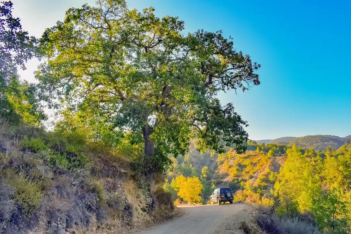
Navigation apps are great for planning, but the MVUM is the enforcement document. The Forest Service calls it "a consistent and standardized law enforcement tool," and it's your responsibility to know whether you're on a route designated for your vehicle. If you use an app, compare its overlay against the forest's own PDF; our onX Offroad vs Gaia GPS comparison covers how each one handles public-land layers.
The MVUM is black and white with no topography, so pair it with a forest visitor map or a topo map for terrain. MVUMs cover National Forest System lands; BLM, national park and state land each have their own travel rules.
Mistakes that lead to MVUM tickets
- Following a track that isn't on the map. User-created routes and old roads often look better than designated ones. They're still closed.
- Riding an unplated machine on a highway-legal-only connector. Even a quarter mile between two trail systems counts.
- Taking a wide UTV onto a 50-inch trail. Factory width, spacers and aftermarket wheels all count.
- Using last year's map. Designations change; the current edition is the one that matters.
- Ignoring the seasonal table. The line looks the same in July and November.
- Camping farther off the road than the map allows. One vehicle length on one forest can be a marked corridor on the next.
Violations of 36 CFR 261.13 carry up to six months in jail, a fine, or both under 36 CFR 261.1b; the Pike and San Isabel MVUM puts the fine at up to $5,000. Beyond the ticket, the Forest Service notes that misuse can lead to temporary or permanent closure of a route for everyone, which is the same reason good trail etiquette matters.
FAQ
Is a route legal if it's on the MVUM but has no sign?
Yes. The Forest Service says designated routes "may not always be signed on the ground but will be identified on the MVUM." The reverse also holds: a route with no sign and no line on the map is closed.
Does a street-legal UTV count as highway legal?
Only if your state licenses it for general operation on all public roads, which is how MVUM legends define highway legal. If your state's plate comes with road restrictions, ask the ranger district before you rely on it.
Do state OHV rules still apply on a road open to all vehicles?
Yes. MVUM legends say you must follow the map as well as all federal, state and local laws, so state rules on OHV registration, rider age and safety equipment still apply on national forest routes.
Does the MVUM show hiking, biking or snowmobile trails?
No. It shows motorized designations only. Non-motorized and mechanized trails appear on visitor maps, and over-snow vehicles are exempt from the MVUM designations.
Who can drive on routes that aren't on the MVUM?
Only exempt uses, such as limited Forest Service administrative use, emergency and law enforcement vehicles, and people with a written authorization like a special use permit. Over-snow vehicles, aircraft and watercraft are also exempt under 36 CFR 261.13.
Before you head out this season, download the current map for the district, run your rig through the checker above, and check that your vehicle actually clears what's legal: our guide on whether your ground clearance is enough is a good next step.

I'm Suryashankar Dasgupta, the founder of Off-Road Handbook. I've been off-roading for years in the USA, including California and Texas, and have ridden mountain and desert terrain abroad. I've also driven a Jeep Compass for more than seven years, so I know the day-to-day side of Jeep ownership first-hand, from the Uconnect screen to the warning lights. Every guide here is researched from manufacturer owner's manuals, NHTSA recall and service-bulletin records and other trusted sources, checked against them before it is published, and corrected when we find a mistake. You can read how we work in our editorial policy: https://offroadhandbook.com/editorial-policy/
Like our off-road guides? Add Off-Road Handbook as a Google Preferred Source so our latest Jeep, ATV, UTV, trail, recovery, and off-road troubleshooting articles can appear more often in your Google Search experience.
Add us as a Preferred Source